As it should be… Navigators could determine latitudes pretty accurately by using astronomy. It was the longitude that was a big problem (maybe that’s part of the reason Japan is placed in the middle of the Pacific).
There was a British miniseries about John Harrison, the clockmaker who figured out how to measure longitude, with Jeremy Irons and Michael Gambon. Worth watching if you can find it or want to watch the shitty quality versions on YouTube.


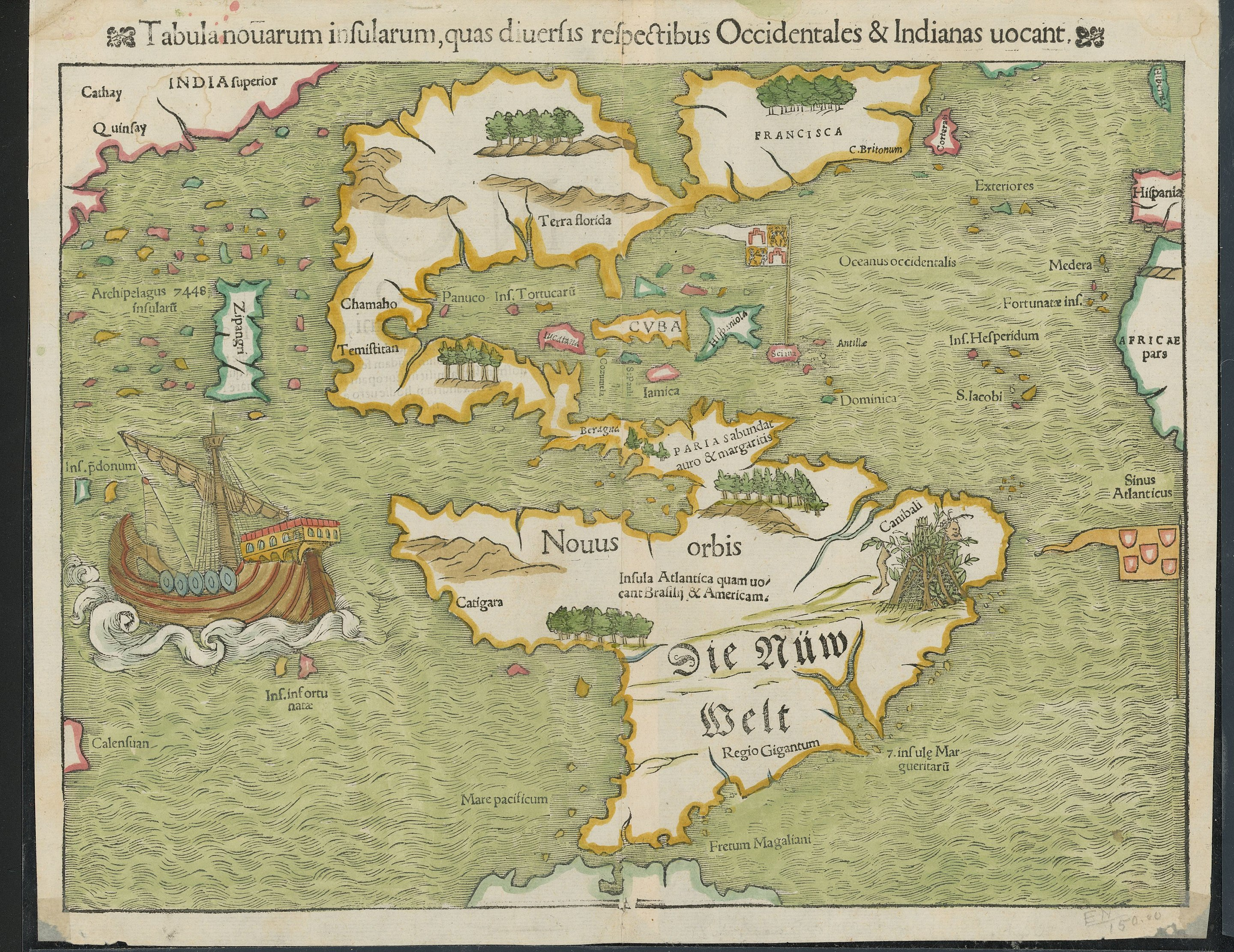
wow. spain is north of florida.
As it should be… Navigators could determine latitudes pretty accurately by using astronomy. It was the longitude that was a big problem (maybe that’s part of the reason Japan is placed in the middle of the Pacific).
There was a British miniseries about John Harrison, the clockmaker who figured out how to measure longitude, with Jeremy Irons and Michael Gambon. Worth watching if you can find it or want to watch the shitty quality versions on YouTube.
Why “wow”…?
um. because its not far off but the replies I got explained the problems they had longitude and how it got better.
North/south would be latitude, so they could easily and accurately position them correctly with respect to that aspect.
Now im a bit confused about the replies I got. That would explain why the shapes are so wierd. I was thinking it was because they only new the coasts